Contact(s)
Water Quality
Municipal wells and other highly vulnerable areas need special attention when it comes to protecting source water. There are several different types of vulnerable source water areas related to water quality, located within Wellington County.
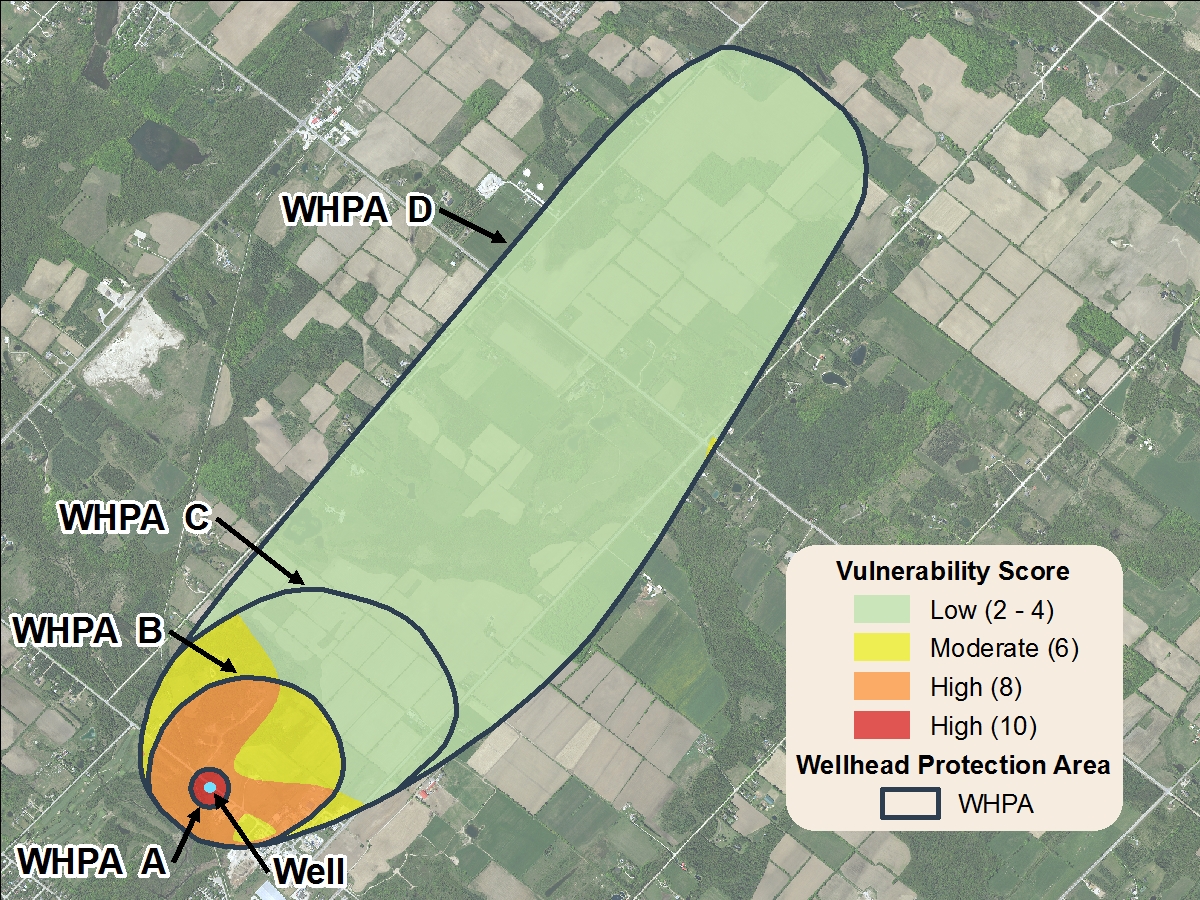
Wellhead protection areas (WHPA)
A wellhead is the physical structure of the well above ground. A Wellhead Protection Area is the area around the wellhead where land use activities have the potential to affect the quality or quantity of water that flows into the well.

Time of travel shows how quickly water (and pollutants) move through the aquifer toward the well. It is measured in years.
WHPA-A- 100m around the well head
WHPA-B- Two year time of travel of water to a well head
WHPA-C- 5 year time of travel of water to a well head
WHPA-D- 25 year time of travel of water to a well head
WHPA-E (not pictured)- represent municipal wells that are under the direct influence of surface water. These well head protection areas usually follow sub watershed boundaries. WHPA-E's are delineated in parts of the Township of Centre Wellington and the Town of Erin.
Vulnerability of a wellhead protection area is measured on a 10-point scale and shows how quickly water (and contaminants) move from the surface to the aquifer based on geological and human made features.
Red- High (score of 10)
Orange- High (score of 8)
Yellow- Moderate (score of 6)
Green - Low (score of 2)
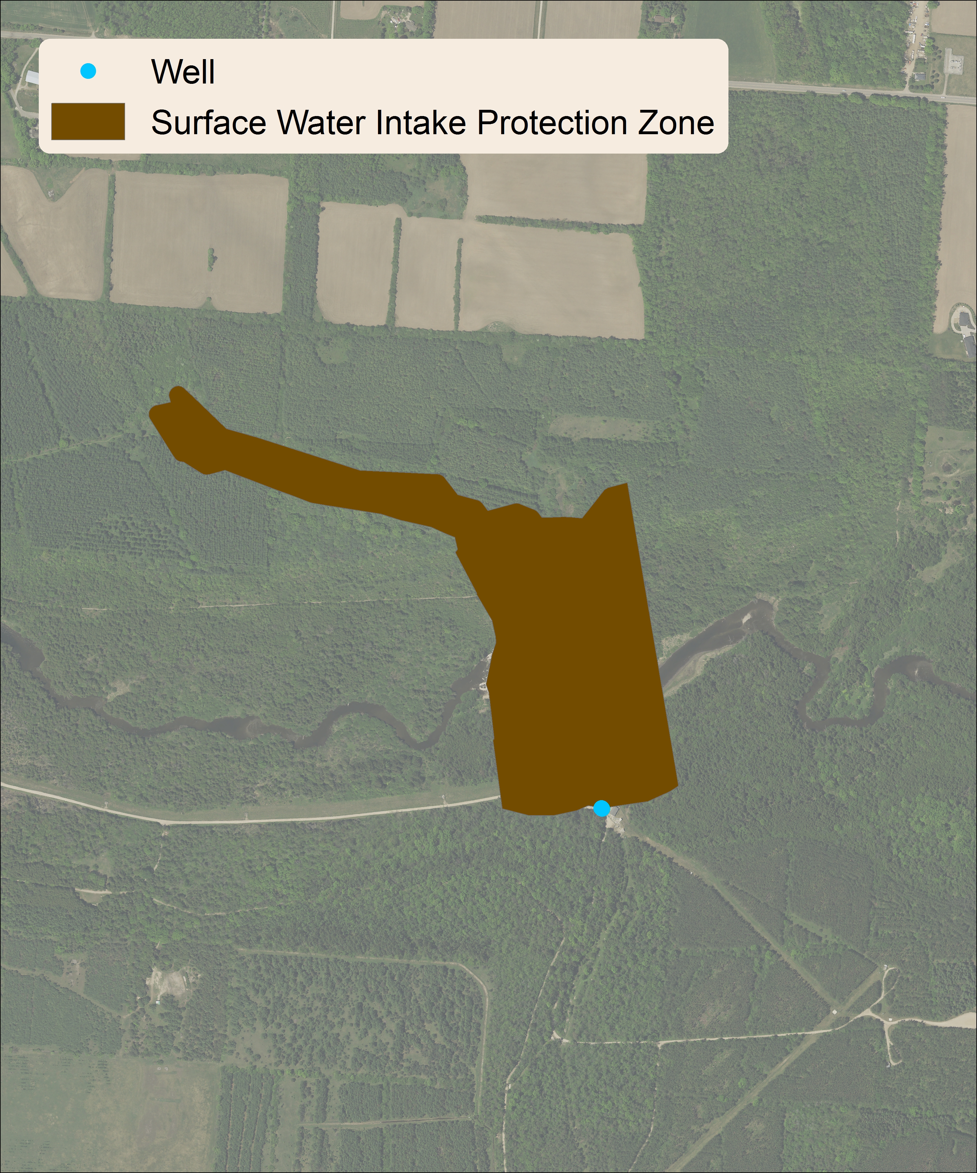
Surface water intake protection zones (IPZ)
Surface water is water that is visible on the landscape, such as our rivers, streams, and lakes. An intake pipe transports water directly from the surface water source to a water treatment system. Protecting the land and water surrounding and upstream of this intake pipe is an important part of maintaining a safe water supply system.

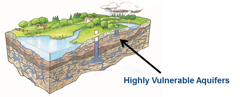
Highly vulnerable aquifers (HVA)
Aquifers are areas of soil or rock under the ground where cracks and spaces allow water to collect. They are considered vulnerable depending on a number of factors, including how deep it is underground, what sort of soil or rock is covering it and the characteristics of the soil or rock. Basically, the faster that water is able to flow through the ground to an aquifer, the more vulnerable it is to contamination. The applicable Source Water Protection Plans rate the vulnerability of aquifers from low vulnerability at 2 up to highly vulnerable at 10. The vulnerability score of an aquifer determines which source protection plan policies apply to each area.

Surface water intake zones: Surface water is water that is visible on the landscape, such as our rivers, streams, and lakes. An intake pipe transports water directly from the surface water source to a water treatment system. Protecting the land and water surrounding and upstream of this intake pipe is an important part of maintaining a safe water supply system.


 Centre Wellington Township
 Guelph/Eramosa Township
 Mapleton Township
 Township of Puslinch
 The Township of Wellington North
 Town of Minto
 County of Wellington
 Town of Erin


